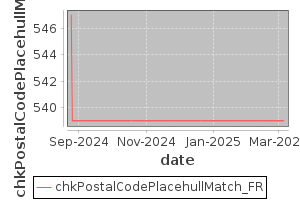
number of errors=539
number of warnings=0
country=FR
Group=chkGrpPostalCode
Group=chkGrpShp
select countrycode,place,numaddresses,array_length(postalcodes,1) as l,postalcodes[1] as pc1,'http://www.geonames.org/maps/google_' || st_y(st_centroid(wkb_geometry)) || '_' || st_x(st_centroid(wkb_geometry)) || '.html' as gnmap from addr_hull_place where geonameid is null and countrycode='FR' order by numaddresses desc
countrycode	place	numaddresses	l	pc1	gnmap
FR	Château-Gontier-sur-Mayenne	7680	1	53200	http://www.geonames.org/maps/google_47.82634589374575_-0.6996616549529283.html
FR	Vire Normandie	7636	1	14500	http://www.geonames.org/maps/google_48.822062055068606_-0.8733351584737635.html
FR	Marseille 8e Arrondissement	7448	1	13008	http://www.geonames.org/maps/google_43.250632957128474_5.377224597496133.html
FR	Marseille 13e Arrondissement	7339	1	13013	http://www.geonames.org/maps/google_43.33999964192132_5.43493237098916.html
FR	Montaigu-Vendée	7242	1	85600	http://www.geonames.org/maps/google_46.97441144739773_-1.3077443718671067.html
FR	Lamballe-Armor	7167	1	22400	http://www.geonames.org/maps/google_48.48423061008406_-2.5360208031171085.html
FR	Lyon 3e Arrondissement	6741	1	69003	http://www.geonames.org/maps/google_45.75323281952613_4.87008482628297.html
FR	Charny Orée de Puisaye	6352	1	89120	http://www.geonames.org/maps/google_47.87314856153954_3.120584648719892.html
FR	Marseille 9e Arrondissement	6196	1	13009	http://www.geonames.org/maps/google_43.24896565300887_5.4130242030750715.html
FR	Doué-en-Anjou	5872	1	49700	http://www.geonames.org/maps/google_47.195543530463404_-0.3003049815952218.html
FR	Moret-Loing-et-Orvanne	5768	1	77250	http://www.geonames.org/maps/google_48.3619974896558_2.807406075683406.html
FR	Paris 8e Arrondissement	5314	1	75008	http://www.geonames.org/maps/google_48.873108335232814_2.3125180496022772.html
FR	Marseille 1er Arrondissement	5026	1	13001	http://www.geonames.org/maps/google_43.29911835247173_5.382108445486223.html
FR	Lyon 8e Arrondissement	4990	1	69008	http://www.geonames.org/maps/google_45.73217781935815_4.868367471264801.html
FR	Marseille 5e Arrondissement	4940	1	13005	http://www.geonames.org/maps/google_43.29294399168194_5.397222033455272.html
FR	Le Mené	4868	1	22330	http://www.geonames.org/maps/google_48.28282566106357_-2.530431609063373.html
FR	Ancenis-Saint-Géréon	4849	1	44150	http://www.geonames.org/maps/google_47.381363247130366_-1.1950904113933756.html
FR	Valserhône	4830	1	01200	http://www.geonames.org/maps/google_46.12209041039601_5.809744328952372.html
FR	Paris 9e Arrondissement	4817	1	75009	http://www.geonames.org/maps/google_48.877049042489574_2.337445915023659.html
FR	Paris 7e Arrondissement	4425	1	75007	http://www.geonames.org/maps/google_48.85592989867743_2.3126462157380847.html
FR	Paris 5e Arrondissement	4337	1	75005	http://www.geonames.org/maps/google_48.84430748855712_2.3502385057056316.html
FR	Lyon 7e Arrondissement	4236	1	69007	http://www.geonames.org/maps/google_45.73510775045663_4.8385988175487595.html
FR	Guipry-Messac	4206	1	35480	http://www.geonames.org/maps/google_47.822471606885266_-1.8302769626435138.html
FR	Cloyes-les-Trois-Rivières	4160	1	28220	http://www.geonames.org/maps/google_47.99948194916973_1.2938920447975308.html
FR	Marseille 16e Arrondissement	4105	1	13016	http://www.geonames.org/maps/google_43.363126330279705_5.324846307026313.html
FR	Machecoul-Saint-Même	4003	1	44270	http://www.geonames.org/maps/google_46.99996993492365_-1.8151047390948247.html
FR	Essarts en Bocage	3988	1	85140	http://www.geonames.org/maps/google_46.78617021849718_-1.2026036350024232.html
FR	Paris 6e Arrondissement	3816	1	75006	http://www.geonames.org/maps/google_48.848997800114596_2.3327020211171674.html
FR	Marseille 3e Arrondissement	3805	1	13003	http://www.geonames.org/maps/google_43.3119644916932_5.379112330330357.html
FR	Ruy-Montceau	3800	1	38300	http://www.geonames.org/maps/google_45.591042417958796_5.346863627396895.html
FR	Marennes-Hiers-Brouage	3757	1	17320	http://www.geonames.org/maps/google_45.82909039417932_-1.1069362334384176.html
FR	Belleville-en-Beaujolais	3754	1	69220	http://www.geonames.org/maps/google_46.12049911287099_4.726407362471451.html
FR	Divatte-sur-Loire	3591	1	44450	http://www.geonames.org/maps/google_47.28032659301183_-1.3314036227539963.html
FR	Domfront en Poiraie	3583	1	61700	http://www.geonames.org/maps/google_48.591123300402245_-0.6537043187964541.html
FR	Les Avenières Veyrins-Thuellin	3575	1	38630	http://www.geonames.org/maps/google_45.63660958871029_5.553487777978084.html
FR	Val de Briey	3519	1	54150	http://www.geonames.org/maps/google_49.250901740654335_5.954920641354409.html
FR	Capavenir Vosges	3489	1	88150	http://www.geonames.org/maps/google_48.25408674097991_6.4175235165166855.html
FR	Le Chesnay-Rocquencourt	3451	1	78150	http://www.geonames.org/maps/google_48.8283541088267_2.122528010224632.html
FR	Lyon 9e Arrondissement	3378	1	69009	http://www.geonames.org/maps/google_45.782564207042334_4.808270346706105.html
FR	Longny les Villages	3364	1	61290	http://www.geonames.org/maps/google_48.54633871082044_0.7858272248572414.html
FR	Paris 2e Arrondissement	3355	1	75002	http://www.geonames.org/maps/google_48.86823252398276_2.342794035149895.html
FR	Lyon 5e Arrondissement	3299	1	69005	http://www.geonames.org/maps/google_45.75633212106381_4.802676137016489.html
FR	Faverges-Seythenex	3238	1	74210	http://www.geonames.org/maps/google_45.741394630480826_6.291794200911195.html
FR	Paris 4e Arrondissement	3197	1	75004	http://www.geonames.org/maps/google_48.85469408420769_2.357471963560694.html
FR	Port-Bail-sur-Mer	3179	1	50580	http://www.geonames.org/maps/google_49.33986311265908_-1.681633201607058.html
FR	Montval-sur-Loir	3177	1	72500	http://www.geonames.org/maps/google_47.69044922426909_0.4249725861777394.html
FR	Paris 1er Arrondissement	3177	1	75001	http://www.geonames.org/maps/google_48.86294038490942_2.336545578636401.html
FR	Les Hauts-d'Anjou	3175	1	49330	http://www.geonames.org/maps/google_47.70110113755487_-0.5377167154913841.html
FR	Bassillac et Auberoche	3171	1	24330	http://www.geonames.org/maps/google_45.160268479617315_0.8850624928542705.html
FR	Saint-Martin-lez-Tatinghem	3090	1	62500	http://www.geonames.org/maps/google_50.75134866874749_2.224780060634328.html
FR	Morcenx-la-Nouvelle	3089	1	40110	http://www.geonames.org/maps/google_44.03295981020609_-0.9022055308115401.html
FR	Souleuvre en Bocage	3073	1	14350	http://www.geonames.org/maps/google_48.933756835616116_-0.8599464632562136.html
FR	Jaunay-Marigny	3065	1	86130	http://www.geonames.org/maps/google_46.718641801022606_0.371361251323572.html
FR	Aubigny-Les Clouzeaux	3036	1	85430	http://www.geonames.org/maps/google_46.62598368292021_-1.4821578836054794.html
FR	Paris 3e Arrondissement	3014	1	75003	http://www.geonames.org/maps/google_48.86280649497643_2.3599092583351142.html
FR	Lyon 6e Arrondissement	2991	1	69006	http://www.geonames.org/maps/google_45.77155942269201_4.852761268582594.html
FR	Tinchebray-Bocage	2984	1	61800	http://www.geonames.org/maps/google_48.73242262064782_-0.7204405647583474.html
FR	Les Abrets en Dauphiné	2906	1	38490	http://www.geonames.org/maps/google_45.5336086789389_5.587362434333809.html
FR	Beaufort-en-Anjou	2887	1	49250	http://www.geonames.org/maps/google_47.439575045562286_-0.2065208996208066.html
FR	Villeneuve-en-Retz	2885	1	44580	http://www.geonames.org/maps/google_47.037908831829746_-1.904610387057176.html
FR	Marseille 2e Arrondissement	2880	1	13002	http://www.geonames.org/maps/google_43.311623643816_5.365287361240439.html
FR	Entrelacs	2861	1	73410	http://www.geonames.org/maps/google_45.78294513120949_5.927108397477259.html
FR	Terres-de-Haute-Charente	2799	1	16270	http://www.geonames.org/maps/google_45.882022314735686_0.5815379200086752.html
FR	Brunstatt-Didenheim	2720	1	68350	http://www.geonames.org/maps/google_47.720735773508636_7.314350156006217.html
FR	Bricquebec-en-Cotentin	2706	1	50260	http://www.geonames.org/maps/google_49.474574448806074_-1.6663301557830306.html
FR	Montrichard Val de Cher	2671	1	41400	http://www.geonames.org/maps/google_47.349158425871416_1.1984158026045966.html
FR	Les Achards	2666	1	85150	http://www.geonames.org/maps/google_46.597095902320085_-1.657105206698954.html
FR	Lyon 2e Arrondissement	2581	1	69002	http://www.geonames.org/maps/google_45.74911643939533_4.825662914401046.html
FR	Vallons-de-l'Erdre	2576	1	44540	http://www.geonames.org/maps/google_47.52688534690128_-1.157752565375175.html
FR	Villedieu-les-Poêles-Rouffigny	2554	1	50800	http://www.geonames.org/maps/google_48.83079899010453_-1.2284160009393414.html
FR	Auneau-Bleury-Saint-Symphorien	2545	1	28700	http://www.geonames.org/maps/google_48.49993680012477_1.764875884372578.html
FR	Loireauxence	2534	1	44370	http://www.geonames.org/maps/google_47.42762667165954_-1.012808875651403.html
FR	La Rochefoucauld-en-Angoumois	2522	1	16110	http://www.geonames.org/maps/google_45.73014399552868_0.36529380152055435.html
FR	Rives de l'Yon	2448	1	85310	http://www.geonames.org/maps/google_46.58999836357196_-1.3437351996721745.html
FR	Bellevigny	2423	1	85170	http://www.geonames.org/maps/google_46.78768853894475_-1.4280348441346777.html
FR	Aigondigné	2416	1	79370	http://www.geonames.org/maps/google_46.291581760824755_-0.2581735585709252.html
FR	Tourouvre au Perche	2395	1	61190	http://www.geonames.org/maps/google_48.59750472597783_0.6386277151539648.html
FR	Val d'Oingt	2373	1	69620	http://www.geonames.org/maps/google_45.93331483697058_4.575278035830069.html
FR	Sèvremont	2323	1	85700	http://www.geonames.org/maps/google_46.83502798888757_-0.838929561168898.html
FR	Maen Roch	2299	1	35460	http://www.geonames.org/maps/google_48.397570684333154_-1.3455697046068877.html
FR	Val de Virvée	2259	1	33240	http://www.geonames.org/maps/google_45.02167658875601_-0.38386963425925735.html
FR	Valence-en-Poitou	2259	1	86700	http://www.geonames.org/maps/google_46.31369671703465_0.209194060510669.html
FR	Val-au-Perche	2255	1	61260	http://www.geonames.org/maps/google_48.28293440208628_0.6996583151598149.html
FR	Bourgvallées	2242	1	50750	http://www.geonames.org/maps/google_49.036886671866434_-1.1319638598423387.html
FR	Val d'Anast	2211	1	35330	http://www.geonames.org/maps/google_47.89960042544783_-1.993975444064083.html
FR	Lyon 4e Arrondissement	2196	1	69004	http://www.geonames.org/maps/google_45.77895287746077_4.824019935856307.html
FR	Terres-de-Caux	2159	1	76640	http://www.geonames.org/maps/google_49.65294134139144_0.5949480904448884.html
FR	Beauce la Romaine	2090	1	41240	http://www.geonames.org/maps/google_47.92545037502255_1.453476112321559.html
FR	Veuzain-sur-Loire	2075	1	41150	http://www.geonames.org/maps/google_47.50703770896002_1.1529696076354008.html
FR	Vair-sur-Loire	2071	1	44150	http://www.geonames.org/maps/google_47.39647690014626_-1.1113287889533536.html
FR	Argentonnay	2065	1	79150	http://www.geonames.org/maps/google_46.966053663837656_-0.4251506052097679.html
FR	Porte-de-Savoie	2045	1	73800	http://www.geonames.org/maps/google_45.492848034094514_6.002348922363936.html
FR	Plateau d'Hauteville	2037	1	01110	http://www.geonames.org/maps/google_45.93395353185755_5.584155159811987.html
FR	Rives d'Andaine	2029	1	61140	http://www.geonames.org/maps/google_48.52968376625746_-0.44749555652002176.html
FR	Lyon 1er Arrondissement	2020	1	69001	http://www.geonames.org/maps/google_45.770175473500565_4.828400215820322.html
FR	Val-de-Moder	2013	1	67350	http://www.geonames.org/maps/google_48.844350184056196_7.611794793940101.html
FR	Blancs-Coteaux	2003	1	51130	http://www.geonames.org/maps/google_48.92334620231087_4.002642258777505.html
FR	Beaussais-sur-Mer	1981	1	22650	http://www.geonames.org/maps/google_48.57056547151507_-2.1588214918545217.html
FR	Vindry-sur-Turdine	1979	1	69490	http://www.geonames.org/maps/google_45.89269488066054_4.494118220731386.html
FR	Kaysersberg Vignoble	1944	1	68240	http://www.geonames.org/maps/google_48.14413586519609_7.263695889830272.html
FR	Grandparigny	1913	1	50600	http://www.geonames.org/maps/google_48.60539052417525_-1.070510018681539.html
FR	Grand Bourgtheroulde	1850	1	27520	http://www.geonames.org/maps/google_49.308881314029925_0.8636936273150574.html
FR	Bosroumois	1848	1	27670	http://www.geonames.org/maps/google_49.28827247067005_0.9200017172564636.html
FR	Montréverd	1844	1	85260	http://www.geonames.org/maps/google_46.90766617694196_-1.4222279852529724.html
FR	Noues de Sienne	1834	1	14380	http://www.geonames.org/maps/google_48.82056499121625_-1.0089701462214467.html
FR	Châtelaudren-Plouagat	1832	1	22170	http://www.geonames.org/maps/google_48.52905985968099_-2.988264077998323.html
FR	Rives-du-Loir-en-Anjou	1827	1	49140	http://www.geonames.org/maps/google_47.56092079343671_-0.43344477539674836.html
FR	Les Villages Vovéens	1824	1	28150	http://www.geonames.org/maps/google_48.277683166187124_1.5860722025826057.html
FR	Rives-en-Seine	1820	1	76490	http://www.geonames.org/maps/google_49.520732394981756_0.7265430183286342.html
FR	Percy-en-Normandie	1815	1	50410	http://www.geonames.org/maps/google_48.913516998388424_-1.1906206183444061.html
FR	Crêts en Belledonne	1788	1	38830	http://www.geonames.org/maps/google_45.36684887751387_6.033006842326381.html
FR	Porte des Pierres Dorées	1785	1	69400	http://www.geonames.org/maps/google_45.96653557523737_4.649391433326234.html
FR	Perche en Nocé	1781	1	61340	http://www.geonames.org/maps/google_48.36600486634279_0.6937422608897714.html
FR	Montcuq-en-Quercy-Blanc	1779	1	46800	http://www.geonames.org/maps/google_44.34266375443864_1.1711964262352046.html
FR	Écouché-les-Vallées	1777	1	61150	http://www.geonames.org/maps/google_48.71848496341194_-0.14630175435545176.html
FR	Bâgé-Dommartin	1770	1	01380	http://www.geonames.org/maps/google_46.32542554597104_4.966347250858531.html
FR	Le Mérévillois	1739	1	91660	http://www.geonames.org/maps/google_48.313540975292455_2.094579136908371.html
FR	Rémalard en Perche	1730	1	61110	http://www.geonames.org/maps/google_48.428700582461815_0.7707056711021856.html
FR	Marigny-Le-Lozon	1728	1	50570	http://www.geonames.org/maps/google_49.124621371716586_-1.262111855424657.html
FR	Margaux-Cantenac	1721	1	33460	http://www.geonames.org/maps/google_45.03568862792809_-0.6731494059626029.html
FR	Le Thuit de l'Oison	1704	1	27370	http://www.geonames.org/maps/google_49.26196865582418_0.9448816754013957.html
FR	Saint-Genix-les-Villages	1698	1	73240	http://www.geonames.org/maps/google_45.6022862958183_5.6699954370358725.html
FR	Amélie-les-Bains-Palalda	1691	1	66110	http://www.geonames.org/maps/google_42.4630845212162_2.6805399644995087.html
FR	Plouguenast-Langast	1686	1	22150	http://www.geonames.org/maps/google_48.279124129492295_-2.697897990838302.html
FR	Grand-Aigueblanche	1685	1	73260	http://www.geonames.org/maps/google_45.5065513061403_6.501137162366862.html
FR	Sévérac d'Aveyron	1685	1	12150	http://www.geonames.org/maps/google_44.325173685179685_3.0457683603864933.html
FR	Tessy-Bocage	1679	1	50420	http://www.geonames.org/maps/google_48.959183155991525_-1.0650131655707002.html
FR	Ducey-Les Chéris	1679	1	50220	http://www.geonames.org/maps/google_48.622748769209366_-1.2627342221562725.html
FR	Neuvéglise-sur-Truyère	1673	1	15260	http://www.geonames.org/maps/google_44.936152477717286_2.9849644978247225.html
FR	Valgelon-La Rochette	1654	1	73110	http://www.geonames.org/maps/google_45.4614169730194_6.123033471583008.html
FR	La Chapelle-Longueville	1629	1	27950	http://www.geonames.org/maps/google_49.10528461348591_1.406360058252638.html
FR	Masevaux-Niederbruck	1627	1	68290	http://www.geonames.org/maps/google_47.77489131271545_6.9880788819019735.html
FR	Aime-la-Plagne	1618	1	73210	http://www.geonames.org/maps/google_45.56052347898978_6.624528673329144.html
FR	Loretz-d'Argenton	1616	1	79290	http://www.geonames.org/maps/google_47.06663142742446_-0.26990970288540383.html
FR	Mesnil-Roc'h	1614	1	35720	http://www.geonames.org/maps/google_48.45579151045146_-1.8796760764385585.html
FR	Sartilly-Baie-Bocage	1586	1	50530	http://www.geonames.org/maps/google_48.750213568026474_-1.4436793761406006.html
FR	Boivre-la-Vallée	1585	1	86470	http://www.geonames.org/maps/google_46.544907583461054_0.07981255108985236.html
FR	Le Hom	1578	1	14220	http://www.geonames.org/maps/google_48.991628569570935_-0.5197693642816413.html
FR	Plounéour-Brignogan-plages	1553	1	29890	http://www.geonames.org/maps/google_48.65430599442688_-4.329125189597207.html
FR	Saint-Jean-d'Elle	1549	1	50810	http://www.geonames.org/maps/google_49.091252795664644_-0.9690764029672643.html
FR	Granges-Aumontzey	1535	1	88640	http://www.geonames.org/maps/google_48.13707179426863_6.797787837871984.html
FR	Treigny-Perreuse-Sainte-Colombe	1533	1	89520	http://www.geonames.org/maps/google_47.56051707181492_3.1946688094923203.html
FR	Milizac-Guipronvel	1530	1	29290	http://www.geonames.org/maps/google_48.46162662250832_-4.569412798503973.html
FR	Valencisse	1525	1	41190	http://www.geonames.org/maps/google_47.57658982270583_1.1944653553602116.html
FR	Arcisses	1519	1	28400	http://www.geonames.org/maps/google_48.33504628578764_0.8996727748377104.html
FR	Val-Revermont	1507	1	01370	http://www.geonames.org/maps/google_46.28765571728353_5.355221281667458.html
FR	Castelnau Montratier-Sainte Alauzie	1499	1	46170	http://www.geonames.org/maps/google_44.26939884938682_1.3446602282948148.html
FR	Valloire-sur-Cisse	1471	1	41150	http://www.geonames.org/maps/google_47.53505817135041_1.214532258522768.html
FR	Morannes sur Sarthe-Daumeray	1459	1	49640	http://www.geonames.org/maps/google_47.71220081430754_-0.39427503112900614.html
FR	Saint-Denis-Lanneray	1455	1	28200	http://www.geonames.org/maps/google_48.08097278470995_1.2467523277105501.html
FR	Beaumontois en Périgord	1451	1	24440	http://www.geonames.org/maps/google_44.73775470492943_0.7514933173141163.html
FR	Caumont-sur-Aure	1448	1	14240	http://www.geonames.org/maps/google_49.1042277731041_-0.8015079147201563.html
FR	Valdallière	1446	1	14410	http://www.geonames.org/maps/google_48.88144694306274_-0.7729051980930599.html
FR	Sablons sur Huisne	1435	1	61110	http://www.geonames.org/maps/google_48.38640575393788_0.8732456721318353.html
FR	Val d'Oust	1433	1	56460	http://www.geonames.org/maps/google_47.87311225108042_-2.428825478170641.html
FR	Laissac-Sévérac l'Église	1415	1	12310	http://www.geonames.org/maps/google_44.361670669032314_2.8271573732473203.html
FR	Saint-Amand-Villages	1401	1	50160	http://www.geonames.org/maps/google_49.04026329959287_-0.9357065605119718.html
FR	Neussargues en Pinatelle	1394	1	15170	http://www.geonames.org/maps/google_45.13671834773318_2.9521838973567474.html
FR	Florac Trois Rivières	1384	1	48400	http://www.geonames.org/maps/google_44.32970066721526_3.59159533285041.html
FR	Saint-Thégonnec Loc-Eguiner	1370	1	29410	http://www.geonames.org/maps/google_48.492145595904894_-3.942742359721022.html
FR	Vicq-sur-Mer	1358	1	50330	http://www.geonames.org/maps/google_49.689241884900866_-1.3837688097882983.html
FR	Arelaune-en-Seine	1356	1	76940	http://www.geonames.org/maps/google_49.48454772812362_0.7474232950537747.html
FR	Janville-en-Beauce	1353	1	28310	http://www.geonames.org/maps/google_48.20017710674085_1.8607161234094898.html
FR	Rives-du-Couesnon	1345	1	35140	http://www.geonames.org/maps/google_48.28650066716331_-1.3534250185392358.html
FR	Val-du-Layon	1344	1	49750	http://www.geonames.org/maps/google_47.31868584392785_-0.6615751926786734.html
FR	Val-d'Oire-et-Gartempe	1340	1	87320	http://www.geonames.org/maps/google_46.231263957860335_0.9122004332488437.html
FR	Pays de Belvès	1328	1	24170	http://www.geonames.org/maps/google_44.751754654976295_0.997627912984694.html
FR	Clef Vallée d'Eure	1326	1	27490	http://www.geonames.org/maps/google_49.11812799697776_1.2511820286798008.html
FR	La Vôge-les-Bains	1313	1	88240	http://www.geonames.org/maps/google_48.013541409394_6.257797534159718.html
FR	Val-d'Aigoual	1306	1	30570	http://www.geonames.org/maps/google_44.08258505128494_3.639828131407098.html
FR	Moult-Chicheboville	1301	1	14370	http://www.geonames.org/maps/google_49.110094164077985_-0.17427055437542277.html
FR	Cherré-Au	1292	1	72400	http://www.geonames.org/maps/google_48.18329522109059_0.6794327513335211.html
FR	Val-de-Sos	1287	1	09220	http://www.geonames.org/maps/google_42.78016598088357_1.4790737178494167.html
FR	Saint Geniez d'Olt et d'Aubrac	1284	1	12130	http://www.geonames.org/maps/google_44.50520925507805_3.0080345074380013.html
FR	Bois-de-Haye	1276	1	54840	http://www.geonames.org/maps/google_48.701378008214334_6.045635520521293.html
FR	Ingrandes-Le Fresne sur Loire	1270	1	49123	http://www.geonames.org/maps/google_47.40856858430273_-0.9259504677772007.html
FR	Hauts de Bienne	1241	1	39400	http://www.geonames.org/maps/google_46.50841091331357_5.978349117027488.html
FR	La Porte du Der	1236	1	52220	http://www.geonames.org/maps/google_48.468418132845784_4.798342116405546.html
FR	Villeneuve-sur-Aisne	1231	1	02190	http://www.geonames.org/maps/google_49.43038055100016_3.979546428276443.html
FR	Saint Aulaye-Puymangou	1230	1	24410	http://www.geonames.org/maps/google_45.18310362082771_0.12614933768164813.html
FR	Évellys	1229	1	56500	http://www.geonames.org/maps/google_47.983895886446646_-2.84744396471701.html
FR	Saint-Paterne - Le Chevain	1215	1	72610	http://www.geonames.org/maps/google_48.41694284422636_0.12332565014279906.html
FR	Creully sur Seulles	1205	1	14480	http://www.geonames.org/maps/google_49.27987921631152_-0.5558447122342398.html
FR	Rountzenheim-Auenheim	1202	1	67480	http://www.geonames.org/maps/google_48.815702435461546_8.014712825147466.html
FR	Les Portes du Coglais	1197	1	35460	http://www.geonames.org/maps/google_48.450130559684794_-1.3332737136610129.html
FR	Deux Rivières	1186	1	89460	http://www.geonames.org/maps/google_47.690454043894945_3.7196807996480405.html
FR	Anizy-le-Grand	1180	1	02320	http://www.geonames.org/maps/google_49.51521021430681_3.4545752378257784.html
FR	Oucques La Nouvelle	1178	1	41290	http://www.geonames.org/maps/google_47.81650275742802_1.2645743504550986.html
FR	Montsenelle	1172	1	50250	http://www.geonames.org/maps/google_49.30668333871495_-1.4463440854607912.html
FR	Glières-Val-de-Borne	1171	1	74130	http://www.geonames.org/maps/google_45.97480054696723_6.382667311312521.html
FR	Mortain-Bocage	1116	1	50140	http://www.geonames.org/maps/google_48.62502583218949_-0.9286869988213143.html
FR	Couëtron-au-Perche	1100	1	41170	http://www.geonames.org/maps/google_48.05580985066006_0.893637885546606.html
FR	Fursac	1091	1	23290	http://www.geonames.org/maps/google_46.14886590502209_1.5161666578245212.html
FR	Val de Louyre et Caudeau	1088	1	24510	http://www.geonames.org/maps/google_44.96749244597987_0.7980216952671646.html
FR	Bresse Vallons	1082	1	01340	http://www.geonames.org/maps/google_46.32523900335554_5.184080151786268.html
FR	Coux et Bigaroque-Mouzens	1079	1	24220	http://www.geonames.org/maps/google_44.84897271452029_0.9777218922095539.html
FR	Bellevigne	1078	1	16120	http://www.geonames.org/maps/google_45.54607196672244_-0.11708802049654153.html
FR	Beaumont-Louestault	1073	1	37360	http://www.geonames.org/maps/google_47.577682171233064_0.6572995418575036.html
FR	Sainte-Suzanne-et-Chammes	1073	1	53270	http://www.geonames.org/maps/google_48.09115470584214_-0.3692319114271914.html
FR	La Léchère	1061	1	73260	http://www.geonames.org/maps/google_45.526193016827925_6.465689287399068.html
FR	Vallières-sur-Fier	1060	1	74150	http://www.geonames.org/maps/google_45.91428831667797_5.927466329611051.html
FR	Jarzé Villages	1060	1	49140	http://www.geonames.org/maps/google_47.55192997484226_-0.24632910787364398.html
FR	Ballon-Saint Mars	1054	1	72290	http://www.geonames.org/maps/google_48.16986782532945_0.2680903146620369.html
FR	Tauxigny-Saint-Bauld	1046	1	37310	http://www.geonames.org/maps/google_47.20590477217459_0.8263246999278177.html
FR	Castelnau d'Auzan Labarrère	1040	1	32440	http://www.geonames.org/maps/google_43.951868216195805_0.11092368394893463.html
FR	Passais Villages	1030	1	61350	http://www.geonames.org/maps/google_48.48818708120532_-0.761650498103642.html
FR	Douchy-Montcorbon	1016	1	45220	http://www.geonames.org/maps/google_47.95623573399737_3.0655297764007137.html
FR	Pré-en-Pail-Saint-Samson	1011	1	53140	http://www.geonames.org/maps/google_48.454979093141205_-0.19530529898982707.html
FR	Beautheil-Saints	1008	1	77120	http://www.geonames.org/maps/google_48.76169728671434_3.0727030268338824.html
FR	Saint François Longchamp	1002	1	73130	http://www.geonames.org/maps/google_45.39705472646982_6.347968138409531.html
FR	Bourgs sur Colagne	997	1	48100	http://www.geonames.org/maps/google_44.522340076068666_3.2546359153873663.html
FR	Montmoreau	996	1	16190	http://www.geonames.org/maps/google_45.40953887777315_0.14023424059232872.html
FR	Entre-Vignes	993	1	34400	http://www.geonames.org/maps/google_43.720360107959976_4.076938153081918.html
FR	Arandon-Passins	991	1	38510	http://www.geonames.org/maps/google_45.702901053458476_5.437492079570929.html
FR	Gavray-sur-Sienne	986	1	50450	http://www.geonames.org/maps/google_48.88637483403117_-1.360732590591048.html
FR	Coteaux du Lizon	981	1	39170	http://www.geonames.org/maps/google_46.40947451569482_5.802566989269679.html
FR	Champigny en Rochereau	980	1	86170	http://www.geonames.org/maps/google_46.721040101594134_0.1562323765835709.html
FR	Valromey-sur-Séran	976	1	01260	http://www.geonames.org/maps/google_45.911792704860794_5.663872158128555.html
FR	Porte-des-Bonnevaux	971	1	38260	http://www.geonames.org/maps/google_45.4337134378357_5.204070830028947.html
FR	Doix lès Fontaines	969	1	85200	http://www.geonames.org/maps/google_46.40791801929747_-0.8118686658625716.html
FR	Castets et Castillon	965	1	33210	http://www.geonames.org/maps/google_44.55117799594444_-0.12856956772941164.html
FR	Saint-Sauveur-Villages	961	1	50490	http://www.geonames.org/maps/google_49.142900691900046_-1.402922257765674.html
FR	Gonneville-Le Theil	957	1	50330	http://www.geonames.org/maps/google_49.61962962776486_-1.4701244676018679.html
FR	Saint-Pardoux-Soutiers	954	1	79310	http://www.geonames.org/maps/google_46.578191420690146_-0.3106461581029887.html
FR	Les Auxons	952	1	25870	http://www.geonames.org/maps/google_47.30014146022511_5.958290909636449.html
FR	Senillé-Saint-Sauveur	930	1	86100	http://www.geonames.org/maps/google_46.79131481929833_0.6340614813344011.html
FR	Chambaron sur Morge	930	1	63200	http://www.geonames.org/maps/google_45.9472353989619_3.150755862190629.html
FR	Tuffalun	927	1	49700	http://www.geonames.org/maps/google_47.27688490765077_-0.33052560870540165.html
FR	Val d'Arry	926	1	14210	http://www.geonames.org/maps/google_49.1125594853583_-0.5637749201625794.html
FR	Villemaury	921	1	28200	http://www.geonames.org/maps/google_48.04913534449152_1.4529200386551735.html
FR	Terre-et-Marais	921	1	50500	http://www.geonames.org/maps/google_49.244670567953094_-1.3119971664459147.html
FR	Bray-Saint-Aignan	919	1	45460	http://www.geonames.org/maps/google_47.82795890745456_2.3633645438827937.html
FR	Rives Dervoises	915	1	52220	http://www.geonames.org/maps/google_48.47793859078382_4.7042023194944065.html
FR	Saint-Dizier-Masbaraud	913	1	23400	http://www.geonames.org/maps/google_46.01650686485799_1.7146780462357842.html
FR	Laize-Clinchamps	911	1	14320	http://www.geonames.org/maps/google_49.08474889522877_-0.3985423396602343.html
FR	Saint Martin de l'If	907	1	76190	http://www.geonames.org/maps/google_49.56605317024653_0.8086867573470845.html
FR	Orval sur Sienne	905	1	50660	http://www.geonames.org/maps/google_49.00962583877597_-1.4724366354828355.html
FR	Loiron-Ruillé	902	1	53320	http://www.geonames.org/maps/google_48.062911766910105_-0.9572968439794377.html
FR	Les Monts d'Andaine	901	1	61600	http://www.geonames.org/maps/google_48.61512678682582_-0.4088829895992127.html
FR	Eclose-Badinières	899	1	38300	http://www.geonames.org/maps/google_45.496110660976704_5.301015320343341.html
FR	Écouves	886	1	61250	http://www.geonames.org/maps/google_48.50906618655185_0.11026404293373923.html
FR	Val-d'Arc	879	1	73220	http://www.geonames.org/maps/google_45.538834957013364_6.3137082558250075.html
FR	Le Ban-Saint-Martin	875	1	57050	http://www.geonames.org/maps/google_49.124851665987215_6.144919606781795.html
FR	Beaufort-Orbagna	870	1	39190	http://www.geonames.org/maps/google_46.587079164837256_5.430647057667903.html
FR	Provenchères-et-Colroy	861	1	88490	http://www.geonames.org/maps/google_48.318749224424614_7.096219458335528.html
FR	Romagny Fontenay	853	1	50140	http://www.geonames.org/maps/google_48.6350675016039_-0.9902428588676014.html
FR	Sorges et Ligueux en Périgord	840	1	24420	http://www.geonames.org/maps/google_45.29555655524743_0.8445173280251642.html
FR	Boischampré	838	1	61570	http://www.geonames.org/maps/google_48.677797472227404_0.012889550926699928.html
FR	Plateau-des-Petites-Roches	837	1	38660	http://www.geonames.org/maps/google_45.318641756786015_5.887228437444284.html
FR	Prats-de-Mollo-la-Preste	834	1	66230	http://www.geonames.org/maps/google_42.41063124723541_2.461914705670917.html
FR	Conques-en-Rouergue	828	1	12320	http://www.geonames.org/maps/google_44.5861866438834_2.384439779586795.html
FR	Les Premiers Sapins	826	1	25580	http://www.geonames.org/maps/google_47.081015032274145_6.339052755556608.html
FR	Éole-en-Beauce	825	1	28150	http://www.geonames.org/maps/google_48.21059128223759_1.6646093204916168.html
FR	Saint Privat en Périgord	825	1	24410	http://www.geonames.org/maps/google_45.228044453320564_0.20864571419155986.html
FR	Enquin-lez-Guinegatte	816	1	62145	http://www.geonames.org/maps/google_50.59331575933421_2.28871258893689.html
FR	Saint-Pierre-La-Noue	813	1	17700	http://www.geonames.org/maps/google_46.0694818808089_-0.8084552874083011.html
FR	Val des Vignes	803	1	16250	http://www.geonames.org/maps/google_45.50415317414666_-0.0183240304751203.html
FR	Pays-de-Clerval	792	1	25340	http://www.geonames.org/maps/google_47.39247792030115_6.513562201740486.html
FR	Le Montsaugeonnais	791	1	52190	http://www.geonames.org/maps/google_47.65933248759752_5.282549954318196.html
FR	Mouilleron-Saint-Germain	790	1	85390	http://www.geonames.org/maps/google_46.680879328655394_-0.8427045273624519.html
FR	Balleroy-sur-Drôme	779	1	14490	http://www.geonames.org/maps/google_49.195114164237886_-0.8368167143080898.html
FR	Les Velluire-sur-Vendée	779	1	85770	http://www.geonames.org/maps/google_46.413731480402234_-0.8993629939299035.html
FR	Le Rouget-Pers	775	1	15290	http://www.geonames.org/maps/google_44.88126154337667_2.239204164831853.html
FR	Sousceyrac-en-Quercy	774	1	46190	http://www.geonames.org/maps/google_44.90886887498771_2.023848944892899.html
FR	Val-de-Virieu	774	1	38730	http://www.geonames.org/maps/google_45.48169469333409_5.472676712625745.html
FR	Goupil-Othon	770	1	27170	http://www.geonames.org/maps/google_49.12014216833556_0.7688190186153228.html
FR	Val-Fouzon	765	1	36210	http://www.geonames.org/maps/google_47.20455147829048_1.6293514431633818.html
FR	Les Bois d'Anjou	764	1	49250	http://www.geonames.org/maps/google_47.46895412932064_-0.17109608914192373.html
FR	Cubjac-Auvézère-Val d'Ans	763	1	24640	http://www.geonames.org/maps/google_45.235492028593974_0.9608686548354212.html
FR	Val de Chaise	763	1	74210	http://www.geonames.org/maps/google_45.76540019627954_6.337261298175636.html
FR	Essouvert	758	1	17400	http://www.geonames.org/maps/google_45.994710978581985_-0.5282126039197027.html
FR	Le Parc	758	1	50870	http://www.geonames.org/maps/google_48.75481381047457_-1.2969109669335999.html
FR	La Vespière-Friardel	757	1	14290	http://www.geonames.org/maps/google_49.005204097826585_0.4054015223247421.html
FR	Aspach-Michelbach	752	1	68700	http://www.geonames.org/maps/google_47.778486581323314_7.130466168644742.html
FR	Ancy-Dornot	748	1	57130	http://www.geonames.org/maps/google_49.054741206856484_6.058145809727245.html
FR	Val Suran	748	1	39320	http://www.geonames.org/maps/google_46.38561353440191_5.440095117165763.html
FR	Dialan sur Chaîne	747	1	14260	http://www.geonames.org/maps/google_48.998979390478524_-0.7418552854570291.html
FR	Val-de-Bonnieure	747	1	16230	http://www.geonames.org/maps/google_45.844139679461634_0.296769557497538.html
FR	Valdelaume	741	1	79110	http://www.geonames.org/maps/google_46.08304845700477_-0.0020550110444696955.html
FR	Illtal	741	1	68960	http://www.geonames.org/maps/google_47.56505150318286_7.298826457534848.html
FR	Sap-en-Auge	741	1	61470	http://www.geonames.org/maps/google_48.888622926019025_0.3256201375930142.html
FR	Mainxe-Gondeville	738	1	16200	http://www.geonames.org/maps/google_45.658108004451044_-0.1761245749461118.html
FR	Groslée-Saint-Benoit	734	1	01300	http://www.geonames.org/maps/google_45.6916737598753_5.5751119994164275.html
FR	Val d'Issoire	730	1	87330	http://www.geonames.org/maps/google_46.10004131571399_0.8941628754119015.html
FR	La Roche-Jaudy	729	1	22450	http://www.geonames.org/maps/google_48.75046947290871_-3.2265680609994267.html
FR	Saintigny	721	1	28480	http://www.geonames.org/maps/google_48.35119573817935_0.9979411320055926.html
FR	Flancourt-Crescy-en-Roumois	719	1	27310	http://www.geonames.org/maps/google_49.322353925320556_0.7772401229898301.html
FR	Le Castelet	712	1	14540	http://www.geonames.org/maps/google_49.089499989217146_-0.2852534864676118.html
FR	Bon Repos sur Blavet	711	1	22570	http://www.geonames.org/maps/google_48.21833227723375_-3.1323976902871165.html
FR	Ponts sur Seulles	707	1	14480	http://www.geonames.org/maps/google_49.283233572864944_-0.5106866421492361.html
FR	Juvigny les Vallées	704	1	50520	http://www.geonames.org/maps/google_48.67679659661896_-1.016373882084271.html
FR	Chenoise-Cucharmoy	700	1	77160	http://www.geonames.org/maps/google_48.608369243743724_3.193015542082844.html
FR	Bellefont-La Rauze	698	1	46090	http://www.geonames.org/maps/google_44.50147005267816_1.4770755948305185.html
FR	Bourgogne-Fresne	698	1	51110	http://www.geonames.org/maps/google_49.34940599344206_4.082008021211711.html
FR	Fragnes-La Loyère	698	1	71530	http://www.geonames.org/maps/google_46.83442863434365_4.842414158765398.html
FR	Guillon-Terre-Plaine	698	1	89420	http://www.geonames.org/maps/google_47.520204064091175_4.065829111367056.html
FR	Bordes-Uchentein	692	1	09800	http://www.geonames.org/maps/google_42.86023634493585_1.0322039375856278.html
FR	Tarcenay-Foucherans	691	1	25620	http://www.geonames.org/maps/google_47.16701938734623_6.115606782070327.html
FR	Gennes-Longuefuye	686	1	53200	http://www.geonames.org/maps/google_47.85380258770682_-0.5865415102621572.html
FR	Tuffé Val de la Chéronne	686	1	72160	http://www.geonames.org/maps/google_48.12726624781042_0.5111872026452481.html
FR	Chambois	686	1	27240	http://www.geonames.org/maps/google_48.90350839624317_1.1509369839958061.html
FR	Castels et Bézenac	678	1	24220	http://www.geonames.org/maps/google_44.86531354744018_1.0758714385419061.html
FR	Colombey les Deux Églises	667	1	52330	http://www.geonames.org/maps/google_48.25369786073445_4.917662280346713.html
FR	Bourneville-Sainte-Croix	665	1	27500	http://www.geonames.org/maps/google_49.39553815905958_0.6207555915333519.html
FR	Lagarde-Marc-la-Tour	664	1	19150	http://www.geonames.org/maps/google_45.188523363805025_1.822501971310898.html
FR	Jugon-les-Lacs - Commune nouvelle	658	1	22270	http://www.geonames.org/maps/google_48.40441745977261_-2.329895182086944.html
FR	Vallée-de-Ronsard	652	1	41800	http://www.geonames.org/maps/google_47.7428632319063_0.6632390998135219.html
FR	Lasserre-Pradère	652	1	31530	http://www.geonames.org/maps/google_43.63996963783129_1.17228832335338.html
FR	Bazouges Cré sur Loir	650	1	72200	http://www.geonames.org/maps/google_47.68197123395652_-0.16343598675346702.html
FR	Cesny-les-Sources	647	1	14220	http://www.geonames.org/maps/google_48.97120142458476_-0.3718952077930548.html
FR	Auchay-sur-Vendée	641	1	85200	http://www.geonames.org/maps/google_46.44013663164158_-0.866749237690444.html
FR	Val-de-Dagne	637	1	11220	http://www.geonames.org/maps/google_43.136335569667665_2.5405935171460516.html
FR	Tart	637	1	21110	http://www.geonames.org/maps/google_47.19450316689705_5.218760832825641.html
FR	Les Hauts-de-Caux	636	1	76190	http://www.geonames.org/maps/google_49.655101815967406_0.751575250082749.html
FR	Le Bosc du Theil	635	1	27370	http://www.geonames.org/maps/google_49.221935909294544_0.8498844064355807.html
FR	Castine-en-Plaine	635	1	14540	http://www.geonames.org/maps/google_49.10796674033936_-0.3183248921988655.html
FR	Prée-d'Anjou	633	1	53200	http://www.geonames.org/maps/google_47.8238964558286_-0.8311958935839125.html
FR	Chalmazel-Jeansagnière	630	1	42920	http://www.geonames.org/maps/google_45.70967779248299_3.8371954354820743.html
FR	Parcoul-Chenaud	625	1	24410	http://www.geonames.org/maps/google_45.203445031758605_0.05362845931234819.html
FR	Les Vallées de la Vanne	617	1	89320	http://www.geonames.org/maps/google_48.17006723267142_3.4593710348767233.html
FR	Valherbasse	612	1	26350	http://www.geonames.org/maps/google_45.21546256179671_5.13829222814842.html
FR	Bourmont-entre-Meuse-et-Mouzon	610	1	52150	http://www.geonames.org/maps/google_48.20675196175967_5.606867346658912.html
FR	Remilly Les Marais	610	1	50570	http://www.geonames.org/maps/google_49.172599195492985_-1.2660427608223732.html
FR	Les Septvallons	610	1	02160	http://www.geonames.org/maps/google_49.35904754626055_3.667777611493435.html
FR	Valorbiquet	602	1	14290	http://www.geonames.org/maps/google_49.06953622751011_0.32609195972613986.html
FR	Deux-Grosnes	601	1	69860	http://www.geonames.org/maps/google_46.24201549664844_4.534490630681788.html
FR	Bierné-les-Villages	601	1	53290	http://www.geonames.org/maps/google_47.775169728285455_-0.5664106954953959.html
FR	Laguenne-sur-Avalouze	599	1	19150	http://www.geonames.org/maps/google_45.247358136536654_1.800338161328955.html
FR	Amfreville-Saint-Amand	597	1	27370	http://www.geonames.org/maps/google_49.219630148226194_0.9296171916424016.html
FR	Val-Sonnette	595	1	39190	http://www.geonames.org/maps/google_46.60435728365102_5.460612830726698.html
FR	Montchevreuil	595	1	60240	http://www.geonames.org/maps/google_49.291688989527245_2.0037392060403927.html
FR	Sépeaux-Saint Romain	589	1	89116	http://www.geonames.org/maps/google_47.9336913861766_3.2338671152193568.html
FR	Thiron-Gardais	586	1	28480	http://www.geonames.org/maps/google_48.30603050310313_1.0134450044298757.html
FR	Saint-Béat-Lez	581	1	31440	http://www.geonames.org/maps/google_42.91290652201962_0.6875784119215554.html
FR	Coteaux-du-Blanzacais	580	1	16250	http://www.geonames.org/maps/google_45.462715484703935_0.019062752037631723.html
FR	Colomby-Anguerny	575	1	14610	http://www.geonames.org/maps/google_49.265073033955105_-0.40414716425982194.html
FR	Vitry-en-Charollais	574	1	71600	http://www.geonames.org/maps/google_46.45896980166353_4.061065478698567.html
FR	Saint Maurice Étusson	574	1	79150	http://www.geonames.org/maps/google_47.038380171720085_-0.5202210350254941.html
FR	Peyre en Aubrac	572	1	48130	http://www.geonames.org/maps/google_44.70924044223217_3.278897995124102.html
FR	Île-de-Batz	572	1	29253	http://www.geonames.org/maps/google_48.74461063696688_-4.014156507373241.html
FR	Réaux sur Trèfle	572	1	17500	http://www.geonames.org/maps/google_45.47523314160829_-0.38059357577529773.html
FR	Banassac-Canilhac	570	1	48500	http://www.geonames.org/maps/google_44.43909079795433_3.187673326700999.html
FR	Ô-de-Selle	569	1	80160	http://www.geonames.org/maps/google_49.77372687536308_2.1768235011222368.html
FR	Cressensac-Sarrazac	568	1	46600	http://www.geonames.org/maps/google_45.02042112077828_1.5574835108257201.html
FR	Marchaux-Chaudefontaine	567	1	25640	http://www.geonames.org/maps/google_47.33001782685459_6.142126362294355.html
FR	Saint-Étienne-de-Cuines	561	1	73130	http://www.geonames.org/maps/google_45.34434597560193_6.29241935252544.html
FR	Langon-sur-Cher	560	1	41320	http://www.geonames.org/maps/google_47.306178901359814_1.8391155667963852.html
FR	Plaine-d'Argenson	554	1	79360	http://www.geonames.org/maps/google_46.132246976742195_-0.4912731252340192.html
FR	Longeault-Pluvault	551	1	21110	http://www.geonames.org/maps/google_47.21830376533271_5.25363195734115.html
FR	Genac-Bignac	548	1	16170	http://www.geonames.org/maps/google_45.80001136167964_0.03029557172860938.html
FR	Méry-Bissières-en-Auge	543	1	14370	http://www.geonames.org/maps/google_49.12753649085134_-0.07843585477836044.html
FR	Parves et Nattages	540	1	01300	http://www.geonames.org/maps/google_45.73074653138325_5.749017974219189.html
FR	Les Hauts Talican	532	1	60390	http://www.geonames.org/maps/google_49.33132232190832_2.0185513115781277.html
FR	Val Buëch-Méouge	525	1	05300	http://www.geonames.org/maps/google_44.241354321080784_5.832817042147859.html
FR	Aunac-sur-Charente	518	1	16460	http://www.geonames.org/maps/google_45.92545892011736_0.2446486328064553.html
FR	Les Trois Châteaux	517	1	39160	http://www.geonames.org/maps/google_46.41708020468432_5.351920140402606.html
FR	Blaison-Saint-Sulpice	512	1	49320	http://www.geonames.org/maps/google_47.384342699782565_-0.3865462569682355.html
FR	Huillé-Lézigné	511	1	49430	http://www.geonames.org/maps/google_47.64359604819771_-0.30943134282907075.html
FR	La Tour-en-Maurienne	511	1	73300	http://www.geonames.org/maps/google_45.29872322880321_6.357143005122722.html
FR	Le Val-Doré	510	1	27190	http://www.geonames.org/maps/google_48.94829894476336_0.989972259338375.html
FR	L'Orée-d'Écouves	508	1	61420	http://www.geonames.org/maps/google_48.52223586900087_-0.03094616523775805.html
FR	Meroux-Moval	507	1	90400	http://www.geonames.org/maps/google_47.591421905615185_6.893102598246167.html
FR	Haut Valromey	506	1	01260	http://www.geonames.org/maps/google_46.03845929053494_5.6830085298702215.html
FR	Le Val d'Ocre	504	1	89110	http://www.geonames.org/maps/google_47.81590348091433_3.296080054169599.html
FR	Nivigne et Suran	500	1	01250	http://www.geonames.org/maps/google_46.27860008806843_5.422900306088286.html
FR	Dhuys et Morin-en-Brie	499	1	02540	http://www.geonames.org/maps/google_48.903145480919655_3.498307604635242.html
FR	La Tour-Blanche-Cercles	499	1	24320	http://www.geonames.org/maps/google_45.36647139079041_0.45463400310217983.html
FR	Thénouville	499	1	27520	http://www.geonames.org/maps/google_49.29435820942137_0.7827819576093167.html
FR	Porte du Ried	494	1	68320	http://www.geonames.org/maps/google_48.11709535878561_7.430738850381322.html
FR	Thoirette-Coisia	492	1	39240	http://www.geonames.org/maps/google_46.28031293990388_5.540842946688832.html
FR	Chassal-Molinges	489	1	39360	http://www.geonames.org/maps/google_46.357100480380225_5.772403195180783.html
FR	Angoustrine-Villeneuve-des-Escaldes	489	1	66760	http://www.geonames.org/maps/google_42.54038919674108_1.9502543155876064.html
FR	Aure sur Mer	484	1	14520	http://www.geonames.org/maps/google_49.34035473401969_-0.8139358411027938.html
FR	Cœur de Causse	483	1	46240	http://www.geonames.org/maps/google_44.65385661653947_1.5391638090444495.html
FR	Servance-Miellin	483	1	70440	http://www.geonames.org/maps/google_47.82506909077424_6.695412113401712.html
FR	Monts-sur-Orne	478	1	61150	http://www.geonames.org/maps/google_48.74772109645785_-0.12071732425543867.html
FR	Val-d'Auge	476	1	16170	http://www.geonames.org/maps/google_45.83817964002528_-0.08605802372508907.html
FR	La Drenne	476	1	60790	http://www.geonames.org/maps/google_49.30231347864299_2.0962853136521686.html
FR	Grande-Rivière Château	471	1	39150	http://www.geonames.org/maps/google_46.52998817417105_5.909039916590523.html
FR	Bellinghem	461	1	62129	http://www.geonames.org/maps/google_50.65990451563738_2.2308089103702313.html
FR	Val d'Arcomie	459	1	15320	http://www.geonames.org/maps/google_44.930994760823985_3.1537301075002637.html
FR	Le Poizat-Lalleyriat	459	1	01130	http://www.geonames.org/maps/google_46.150783042137455_5.6949661176924815.html
FR	Val-du-Faby	457	1	11260	http://www.geonames.org/maps/google_42.92954869049564_2.170291238545824.html
FR	Arboys en Bugey	452	1	01300	http://www.geonames.org/maps/google_45.718594012862184_5.646472921877581.html
FR	Parsac-Rimondeix	450	1	23140	http://www.geonames.org/maps/google_46.19738356800794_2.1328873643236865.html
FR	Les Hauts de Forterre	447	1	89560	http://www.geonames.org/maps/google_47.6172771699263_3.4348374044703935.html
FR	Buais-Les-Monts	444	1	50640	http://www.geonames.org/maps/google_48.51861950907353_-0.972657987879581.html
FR	Vallées en Champagne	444	1	02330	http://www.geonames.org/maps/google_49.00901475674294_3.61508166101913.html
FR	Marcillé	437	1	79500	http://www.geonames.org/maps/google_46.194233203345526_-0.1302320281996273.html
FR	Ornacieux-Balbins	435	1	38260	http://www.geonames.org/maps/google_45.39847744436907_5.214740187974952.html
FR	Val-du-Maine	429	1	53340	http://www.geonames.org/maps/google_47.93635537886377_-0.39905112090214656.html
FR	Osselle-Routelle	429	1	25320	http://www.geonames.org/maps/google_47.15666667880464_5.854040749318413.html
FR	Blandouet-Saint Jean	422	1	53270	http://www.geonames.org/maps/google_48.04650788707449_-0.3662555429128459.html
FR	Le Haut Soultzbach	416	1	68780	http://www.geonames.org/maps/google_47.734084174528576_7.049260673815818.html
FR	Saint-Julien-d'Intres	414	1	07310	http://www.geonames.org/maps/google_44.978821365874886_4.342473677143944.html
FR	Valzin en Petite Montagne	413	1	39240	http://www.geonames.org/maps/google_46.42954301056469_5.581931297924.html
FR	Sigoulès-et-Flaugeac	411	1	24240	http://www.geonames.org/maps/google_44.75624605644296_0.41508972868171506.html
FR	Louplande	396	1	72210	http://www.geonames.org/maps/google_47.943568987277075_0.041223160750457295.html
FR	La Chapelle du Lou du Lac	394	1	35360	http://www.geonames.org/maps/google_48.215195072186795_-1.9930472288432133.html
FR	Forges de Lanouée	393	1	56120	http://www.geonames.org/maps/google_47.988978141835155_-2.5939337071918334.html
FR	Champdor-Corcelles	392	1	01110	http://www.geonames.org/maps/google_46.03167039636122_5.583549589454208.html
FR	Saint-Offenge	388	1	73100	http://www.geonames.org/maps/google_45.73696100433458_6.000581320767586.html
FR	Le Lesme	387	1	27160	http://www.geonames.org/maps/google_48.908143989665014_0.8452323437759726.html
FR	Salins-Fontaine	385	1	73600	http://www.geonames.org/maps/google_45.46601936050166_6.517989117435675.html
FR	Sainte-Marie-d'Attez	383	1	27160	http://www.geonames.org/maps/google_48.80776385167517_0.9697826791822955.html
FR	Val de Livre	381	1	51150	http://www.geonames.org/maps/google_49.0995667599733_4.111542345814686.html
FR	Nonette-Orsonnette	376	1	63340	http://www.geonames.org/maps/google_45.47350161943148_3.293325167579449.html
FR	La Chailleuse	376	1	39270	http://www.geonames.org/maps/google_46.58260326996816_5.52158993278703.html
FR	Cessières-Suzy	373	1	02320	http://www.geonames.org/maps/google_49.555298984066965_3.4828329292000686.html
FR	Meaulne-Vitray	372	1	03360	http://www.geonames.org/maps/google_46.60274619268471_2.6177088879353296.html
FR	Mittainvilliers-Vérigny	371	1	28190	http://www.geonames.org/maps/google_48.516009439469244_1.3255716457000941.html
FR	Blaignan-Prignac	364	1	33340	http://www.geonames.org/maps/google_45.32021537014516_-0.8856755942256371.html
FR	La Baronnie	360	1	27220	http://www.geonames.org/maps/google_48.94437386036139_1.2626570661811054.html
FR	Hypercourt	358	1	80320	http://www.geonames.org/maps/google_49.80910868606951_2.851781804790213.html
FR	Les Coteaux Périgourdins	358	1	24120	http://www.geonames.org/maps/google_45.09441978927086_1.3690684051448665.html
FR	Vaux d'Amognes	353	1	58130	http://www.geonames.org/maps/google_47.07009959465991_3.292638766738416.html
FR	Porte-de-Benauge	353	1	33760	http://www.geonames.org/maps/google_44.681233729229334_-0.24108823408468202.html
FR	Montsecret-Clairefougère	349	1	61800	http://www.geonames.org/maps/google_48.80033763500923_-0.6781404231499307.html
FR	Marchélepot-Misery	347	1	80200	http://www.geonames.org/maps/google_49.84021371305463_2.8783501729965253.html
FR	Chantepérier	343	1	38740	http://www.geonames.org/maps/google_44.953597802985094_5.967797374321547.html
FR	Étinehem-Méricourt	339	1	80340	http://www.geonames.org/maps/google_49.920967968904726_2.679866844728706.html
FR	Villers Saint Frambourg-Ognon	338	1	60810	http://www.geonames.org/maps/google_49.249518258040204_2.640521816302285.html
FR	Châtel-en-Trièves	335	1	38710	http://www.geonames.org/maps/google_44.8419361670997_5.818836915697994.html
FR	Vaire	330	1	25220	http://www.geonames.org/maps/google_47.28107340652234_6.141503339004251.html
FR	Demange-Baudignécourt	324	1	55130	http://www.geonames.org/maps/google_48.585769783170605_5.474635818323564.html
FR	Haut-Bocage	323	1	03190	http://www.geonames.org/maps/google_46.46744018152916_2.678871126638431.html
FR	Solaure en Diois	323	1	26150	http://www.geonames.org/maps/google_44.70632650534538_5.399464538555877.html
FR	La Romaine	322	1	70130	http://www.geonames.org/maps/google_47.53457966572597_5.893215339118708.html
FR	Seveux-Motey	319	1	70130	http://www.geonames.org/maps/google_47.54149489293055_5.7549585933748135.html
FR	Belsentes	318	1	07160	http://www.geonames.org/maps/google_44.90821538006075_4.511044779347913.html
FR	Pont de Montvert - Sud Mont Lozère	316	1	48220	http://www.geonames.org/maps/google_44.36185046810791_3.742774509758296.html
FR	Septmoncel les Molunes	311	1	39310	http://www.geonames.org/maps/google_46.36705441845672_5.925180594072587.html
FR	Manderen-Ritzing	310	1	57480	http://www.geonames.org/maps/google_49.444417475143474_6.451686386329252.html
FR	Val-Mont	305	1	21340	http://www.geonames.org/maps/google_47.0331112700966_4.606272968518058.html
FR	Val-de-Vie	298	1	14140	http://www.geonames.org/maps/google_48.95640181231606_0.16148760637745682.html
FR	Beaussais-Vitré	295	1	79370	http://www.geonames.org/maps/google_46.28363525537676_-0.1742019659438435.html
FR	Le Vernet-Chaméane	293	1	63580	http://www.geonames.org/maps/google_45.47711011933315_3.4619127026787067.html
FR	La Corne en Vexin	292	1	60240	http://www.geonames.org/maps/google_49.29412116430807_1.9330042806690977.html
FR	Varize-Vaudoncourt	288	1	57220	http://www.geonames.org/maps/google_49.129671168071724_6.451483605570661.html
FR	Garde-Colombe	288	1	05300	http://www.geonames.org/maps/google_44.35099280427909_5.7716728524696945.html
FR	Mont Lozère et Goulet	286	1	48190	http://www.geonames.org/maps/google_44.520406893384695_3.739844074957463.html
FR	Chémery-Chéhéry	283	1	08450	http://www.geonames.org/maps/google_49.61732043116879_4.8635148325320605.html
FR	Ance Féas	277	1	64570	http://www.geonames.org/maps/google_43.15904799217269_-0.6943378292941456.html
FR	Valojoulx	270	1	24290	http://www.geonames.org/maps/google_45.014541838829075_1.1491242513579258.html
FR	Rezonville-Vionville	268	1	57130	http://www.geonames.org/maps/google_49.09378902644025_5.966808742753873.html
FR	Saint-Hymetière-sur-Valouse	262	1	39240	http://www.geonames.org/maps/google_46.348276775867376_5.567243544886768.html
FR	Montillières-sur-Orne	251	1	14210	http://www.geonames.org/maps/google_49.04598562422165_-0.47802500013563687.html
FR	Colligny-Maizery	248	1	57530	http://www.geonames.org/maps/google_49.10567549803462_6.3366629225099596.html
FR	Montlainsia	245	1	39320	http://www.geonames.org/maps/google_46.37199564484566_5.479801635256265.html
FR	Flez-Cuzy	244	1	58190	http://www.geonames.org/maps/google_47.359582099090424_3.6302267440514444.html
FR	Bernay-Neuvy-en-Champagne	243	1	72240	http://www.geonames.org/maps/google_48.07195596492299_-0.03486777836172723.html
FR	Hérouville-en-Vexin	241	1	95300	http://www.geonames.org/maps/google_49.101564236978_2.1308891169640747.html
FR	Belle Vie en Auge	227	1	14270	http://www.geonames.org/maps/google_49.10896917095833_-0.028455414260038413.html
FR	Clara-Villerach	223	1	66500	http://www.geonames.org/maps/google_42.58970642083286_2.444873631500907.html
FR	Eyraud-Crempse-Maurens	216	1	24140	http://www.geonames.org/maps/google_44.94080294017763_0.47785123768692733.html
FR	Les Châteliers	213	1	79340	http://www.geonames.org/maps/google_46.50236475237549_-0.14675504404092732.html
FR	Vincent-Froideville	212	1	39230	http://www.geonames.org/maps/google_46.793852049770585_5.482902879540796.html
FR	Oxelaëre	209	1	59670	http://www.geonames.org/maps/google_50.779951640124715_2.4685035672533338.html
FR	Gageac-et-Rouillac	208	1	24240	http://www.geonames.org/maps/google_44.8044861140953_0.35690593622186817.html
FR	Aulhat-Flat	206	1	63500	http://www.geonames.org/maps/google_45.57128750444215_3.304787221933499.html
FR	Saint-Pierre-de-l'Isle	206	1	17330	http://www.geonames.org/maps/google_46.02956551101738_-0.4451806949758123.html
FR	Linard-Malval	194	1	23220	http://www.geonames.org/maps/google_46.36269115456552_1.878416618883045.html
FR	Terre-de-Bancalié	190	1	81120	http://www.geonames.org/maps/google_43.791105546955976_2.251805656669362.html
FR	Clux-Villeneuve	187	1	71270	http://www.geonames.org/maps/google_46.95683966048513_5.176511005457015.html
FR	Aulos-Sinsat	187	1	09310	http://www.geonames.org/maps/google_42.796323468224024_1.6672001210209042.html
FR	Valforêt	183	1	21220	http://www.geonames.org/maps/google_47.23897036836158_4.865453934899044.html
FR	Massegros Causses Gorges	183	1	48500	http://www.geonames.org/maps/google_44.27969285322386_3.2274093154284436.html
FR	Geiswiller-Zœbersdorf	182	1	67270	http://www.geonames.org/maps/google_48.78948420523191_7.5107506896225775.html
FR	Vosbles-Valfin	177	1	39240	http://www.geonames.org/maps/google_46.36006152529981_5.521481217737713.html
FR	Pronville-en-Artois	176	1	62860	http://www.geonames.org/maps/google_50.17397139255147_3.003317392303821.html
FR	Saint-Constant-Fournoulès	170	1	15600	http://www.geonames.org/maps/google_44.68377334169099_2.2299259581518753.html
FR	Saint-Julien-Innocence-Eulalie	165	1	24500	http://www.geonames.org/maps/google_44.718182167449626_0.39326282652858463.html
FR	Saint-Rémy-en-Comté	163	1	70160	http://www.geonames.org/maps/google_47.83583952351657_6.097143885391003.html
FR	Saint-Pierre-Colamine	161	1	63610	http://www.geonames.org/maps/google_45.52724078120716_2.9720634216711557.html
FR	Cormot-Vauchignon	160	1	21340	http://www.geonames.org/maps/google_46.969926181712744_4.645144428731029.html
FR	Les Cluses	159	1	66480	http://www.geonames.org/maps/google_42.48947041737271_2.839726740858028.html
FR	Bors (Canton de Charente-Sud)	154	1	16360	http://www.geonames.org/maps/google_45.32719338931544_-0.19806923421965142.html
FR	Val de Lambronne	153	1	11230	http://www.geonames.org/maps/google_43.07586395828242_1.988838459244091.html
FR	Aurseulles	151	1	14240	http://www.geonames.org/maps/google_49.13409358230528_-0.7112026966225742.html
FR	La Jemaye-Ponteyraud	151	1	24410	http://www.geonames.org/maps/google_45.16563841760159_0.2596658602397838.html
FR	Carnoy-Mametz	143	1	80300	http://www.geonames.org/maps/google_49.99117866334743_2.745085191799901.html
FR	Le Mesnil-Saint-Jean	138	1	27560	http://www.geonames.org/maps/google_49.21835219643185_0.5621985366066364.html
FR	Polisy	138	1	10110	http://www.geonames.org/maps/google_48.06024211106212_4.364610232694803.html
FR	Plœuc-L'Hermitage	131	1	22150	http://www.geonames.org/maps/google_48.321636007192275_-2.8299164469738187.html
FR	Montbolo	121	1	66110	http://www.geonames.org/maps/google_42.48861147006327_2.642919702307991.html
FR	Les Pechs du Vers	121	1	46360	http://www.geonames.org/maps/google_44.59696015675328_1.5793337956752684.html
FR	Cuverville-sur-Yères	119	1	76260	http://www.geonames.org/maps/google_49.95067640462894_1.3878252719571913.html
FR	Val d'Étangson	118	1	72120	http://www.geonames.org/maps/google_47.89470849762156_0.617403504053811.html
FR	Omey	115	1	51240	http://www.geonames.org/maps/google_48.84950228175007_4.494759148722174.html
FR	Naussac-Fontanes	112	1	48300	http://www.geonames.org/maps/google_44.72903090555917_3.838447735327913.html
FR	Hodenc-l'Évêque	107	1	60430	http://www.geonames.org/maps/google_49.33730796171449_2.147617888381577.html
FR	Gorges du Tarn Causses	102	1	48210	http://www.geonames.org/maps/google_44.3668991441452_3.4862189577025924.html
FR	Estal	102	1	46130	http://www.geonames.org/maps/google_44.91569791606325_1.9169797932190016.html
FR	Benqué-Molère	96	1	65130	http://www.geonames.org/maps/google_43.09789680706128_0.284711328370818.html
FR	Malherbe-sur-Ajon	94	1	14260	http://www.geonames.org/maps/google_49.04895579117181_-0.5772628815009132.html
FR	Surjoux-Lhopital	93	1	01420	http://www.geonames.org/maps/google_46.02763617063315_5.797649290824855.html
FR	Chenillé-Champteussé	88	1	49220	http://www.geonames.org/maps/google_47.66613446718827_-0.6550553981835996.html
FR	Vimarcé	85	1	53160	http://www.geonames.org/maps/google_48.19255829768096_-0.2262264088144887.html
FR	Montmérac	82	1	16300	http://www.geonames.org/maps/google_45.44002394473542_-0.2186481290392922.html
FR	Bors (Canton de Tude-et-Lavalette)	76	1	16190	http://www.geonames.org/maps/google_45.340872225418615_0.14744033554365132.html
FR	Saulmory-Villefranche	73	1	55110	http://www.geonames.org/maps/google_49.43844497040804_5.176440993123714.html
FR	Lafarre	54	1	07520	http://www.geonames.org/maps/google_45.07484745050337_4.512883666105997.html
FR	Belloy-Saint-Léonard	51	1	80270	http://www.geonames.org/maps/google_49.90606236655336_1.9031431257244544.html
FR	Culètre	49	1	21230	http://www.geonames.org/maps/google_47.14802319135205_4.569980458855395.html
FR	Estampures	49	1	65220	http://www.geonames.org/maps/google_43.37520185452827_0.285161720305888.html
FR	Vallouise-Pelvoux	44	1	05340	http://www.geonames.org/maps/google_44.84561785672544_6.495759623771164.html
FR	Fontrieu	43	1	81260	http://www.geonames.org/maps/google_43.65278697559657_2.5037106107438616.html
FR	Miraval-Cabardès	42	1	11380	http://www.geonames.org/maps/google_43.380434396059_2.340668970858691.html
FR	Bourniquel	42	1	24150	http://www.geonames.org/maps/google_44.80652053458641_0.7675184795274994.html
FR	Douaumont-Vaux	38	1	55400	http://www.geonames.org/maps/google_49.21039612845578_5.474801160679737.html
FR	Saint Bonnet-Laval	36	1	48600	http://www.geonames.org/maps/google_44.81554875523139_3.73320369346596.html
FR	Francillon	33	1	36110	http://www.geonames.org/maps/google_46.9416238903296_1.5611195712169061.html
FR	L'Albère	32	1	66480	http://www.geonames.org/maps/google_42.47582788560749_2.893165090844614.html
FR	Le Bas Ségala	28	1	12200	http://www.geonames.org/maps/google_44.29776090767716_2.1274330674559927.html
FR	Terres de Druance	27	1	14770	http://www.geonames.org/maps/google_48.92066814090325_-0.6593760908678464.html
FR	Ubaye-Serre-Ponçon	25	1	04340	http://www.geonames.org/maps/google_44.4418134717881_6.324823147804728.html
FR	La Balme	19	1	73170	http://www.geonames.org/maps/google_45.666077680963504_5.701001322042575.html
FR	Espinas	18	1	82160	http://www.geonames.org/maps/google_44.19604666666666_1.7706010000000014.html
FR	Dévoluy	18	1	05250	http://www.geonames.org/maps/google_44.693713796533515_5.904032328098063.html
FR	Abriès-Ristolas	17	1	05460	http://www.geonames.org/maps/google_44.80147587723382_6.934565240541643.html
FR	Bédouès-Cocurès	17	1	48400	http://www.geonames.org/maps/google_44.34501573565987_3.61196694242624.html
FR	Lendou-en-Quercy	14	1	46800	http://www.geonames.org/maps/google_44.31268180496036_1.2678258847686021.html
FR	Gavarnie-Gèdre	14	1	65120	http://www.geonames.org/maps/google_42.77858302819364_0.0065131981679958295.html
FR	Barguelonne-en-Quercy	14	1	46800	http://www.geonames.org/maps/google_44.358216_1.2315300000000042.html
FR	Boisné-La Tude	13	1	16320	http://www.geonames.org/maps/google_45.46843990175_0.19397166212992864.html
FR	Val d'Oronaye	10	1	04530	http://www.geonames.org/maps/google_44.457658395530075_6.851229324606935.html
FR	Sant'Andréa-d'Orcino	10	1	20151	http://www.geonames.org/maps/google_42.057128073731576_8.75092516773854.html
FR	Bréau-Mars	10	1	30120	http://www.geonames.org/maps/google_43.98757215683029_3.573536487989978.html
FR	Marnhagues-et-Latour	10	1	12540	http://www.geonames.org/maps/google_43.87543105552447_3.0320343323458747.html
FR	Norroy-le-Veneur	7	1	57140	http://www.geonames.org/maps/google_49.173343593081064_6.152877215382405.html
FR	Montégut-Arros	6	1	32730	http://www.geonames.org/maps/google_43.37512599999999_0.2245573333333106.html
FR	Porte-du-Quercy	6	1	46800	http://www.geonames.org/maps/google_44.400946420502784_1.1789161332027422.html
FR	La Nouaille	5	1	23500	http://www.geonames.org/maps/google_45.79793377596278_2.0854332282927586.html
FR	Puycapel	5	1	15340	http://www.geonames.org/maps/google_44.71005148725457_2.356824207664537.html
FR	Casaglione	5	1	20111	http://www.geonames.org/maps/google_42.06847413647689_8.737823926036095.html
FR	Saint-Laurent-les-Bains-Laval-d'Aurelle	5	1	07590	http://www.geonames.org/maps/google_44.57612266666666_3.9523176666666666.html
FR	Saint Géry-Vers	5	1	46330	http://www.geonames.org/maps/google_44.47298950603274_1.5818493374824953.html
FR	Saint-Paul-Flaugnac	4	1	46170	http://www.geonames.org/maps/google_44.29337533333334_1.4408716666666666.html
FR	Notre-Dame-d'Estrées-Corbon	3	1	14340	http://www.geonames.org/maps/google_49.133189386582636_-0.014794176919430392.html